DJI - Terrain Informed Flight for DJI Drones
Terrain Informed Flights for DJI Drones
Overview
What
Terrain informed flight planning is a FieldAgent iOS feature that allows users to plan flights with a consistent distance above the ground over hilly terrain. During flight planning, FieldAgent will use elevation data of the flight area it receives from an online source and adjust the altitudes of the flight plan accordingly.
Why
#1. As always -- Safety. Many flight plans that were previously unsafe or impossible to fly due to hilly terrain are now attainable. When a hill is in the middle of a flight boundary, the flight plan should instruct the drone to go up and over.
That said, flight plans still need to be verified and altered to maintain safe distances from trees and other potential hazards.
#2. Data quality and consistency -- Most analytics, such as stand and tassel counts, are trained on imagery captured with a set resolution. The closer imagery can be captured to the expected resolution, the more accurate the results will be. Consistently capturing at the same altitude above the crops throughout flight will produce better results.
Warnings
When used correctly, terrain informed flights can be safer, avoiding large changes in terrain elevation. That said, there are precautions to note:
- Your drone will NOT reactively follow terrain or other obstacles. The collision avoidance sensors on your drone are not used to react to changes in terrain and should never be relied on to stop the drone during flight. The path and altitude of the entire flight is set before take-off, when the flight plan is uploaded to the drone.
- The adjusted flight altitude is only based on ground elevation data. The drone therefore does NOT account for or react to anything above ground level, including trees, powerlines, buildings, or any other tall objects in the planned flight path. If terrain informed flight planning is turned on for a 50ft flight, it will not fly over a 50ft tree. If it appears that the drone may collide with anything during flight, take over immediately (see below).
How to Use
To plan a terrain informed flight:
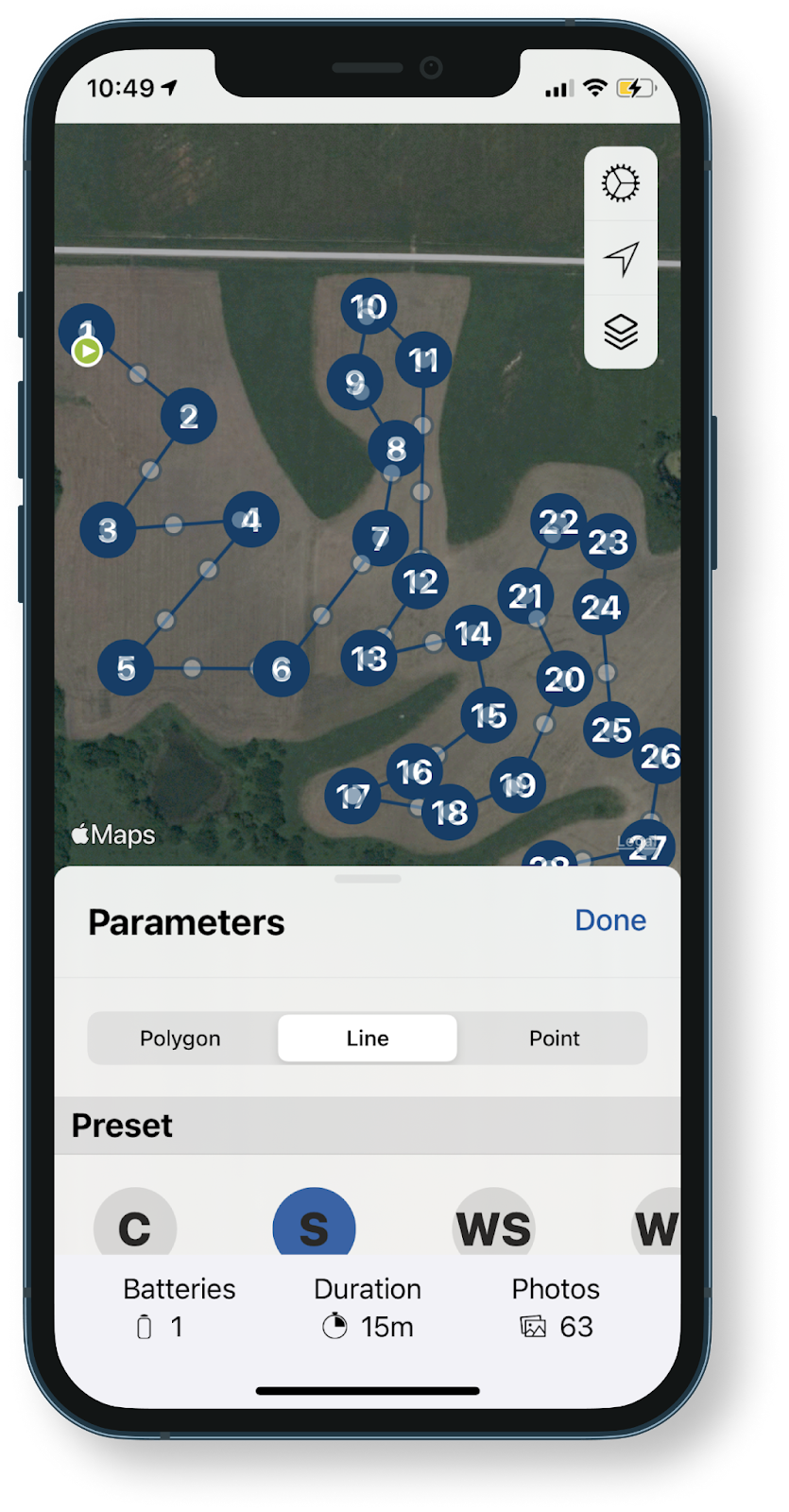
- Plan a mission as you normally would. Set boundaries, cameras, presets, etc.
- Toggle on the Terrain Informed option before takeoff.
Select Review to verify the flight plan is accurate and safe. The coloring of the flight plan reflects the altitude at which the drone will be at throughout flight; green = higher, red = lower.
Remember, the flight plan does not account for trees. If your flight plan passes through the path of a tree, adjust the boundaries or buffer as necessary by clicking into that segment of the flight plan.
If your flight plan consists of multiple segments, use the arrows on the sides of the graph to different segment
Flight Planning with Trees
Concave flight boundaries with surrounding trees should be replanned as line missions. Look closely at planned flight routes before pressing launch. Some flight patterns with concave flight boundaries may cut through the boundaries. Cutting through the boundary is the most efficient path, but not the safest. To solve this problem, clear the flight plan and, in the order the drone can safely fly, select all the locations where you would like to capture an image for stand count. Planning flights in this manner also makes it less likely that images are captured over areas where a stand count may not be possible (ex. Over terracing or irrigation channels). See below for an example of a custom planned line flight that ensures the drone will not cross over trees while capturing photos.
How it Works
Terrain informed flight planning compares a set flight plan to an online elevation data source and the altitude of waypoints throughout the flight plan to maintain a constant altitude above the ground.
Requirements
Terrain Informed flight planning requires:
- Any FieldAgent compatible DJI Drone (Phantom 4 Pro V2, Mavic 2 Pro, M300 etc.)
- Internet Connection
Without an internet connection, Fieldagent is unable to query the terrain elevation database for the locations in the flight plan. Currently FieldAgent does not have capabilities to save flight plans for offline use.
When to Use
Terrain Informed Flight plans are most useful for Stand & Tassel Counts over hilly terrain.
Takeover in an Emergency
You are responsible for the drone throughout the entire flight.
If flight progress needs to be interrupted at any point during the drone's planning route:
- Press and hold the Return to Home (RTH) button on your controller. The controller will begin to beep. The drone will exit the flight plan and adjust it's altitude to the transit altitude that was set in FieldAgent prior to takeoff. The drone will then fly to the recorded home point in an attempt to land.
- If you need to maneuver the drone manually, press the RTH button once more. You'll have full control of the drone with the sticks on the remote control.
Frequently Asked Questions
Q: Where is the elevation data from?
A: Google Elevation API
Q: I flew a mapping flight with Terrain informed ON and my QuickTile from the flight looks odd
A: QuickTiles are created assuming the terrain is flat. Imagery collected over hilly terrain with Terrain Informed flight planning ON may look odd. This can be fixed in FieldAgent Desktop by rerunning the QuickTile and providing the alittude the drone was told to maintain above ground level throughout the flight!
- Open the QuickTile on the Field Page on FieldAgent Desktkop
- Click the gear icon dropdown
next to the name of the QuickTile you want to regenerate
- Click Regenerate
- Enter an Override Altitude in meters where promted. (200feet = 61meters, 400feet = 122 meters)
- Click OK. The QuickTile will regenerate.
Related Articles
FieldAgent Mobile - Setting DJI Controller Flight Modes
Depending on your device, set your DJI controller to the following modes: F Mode: Phantom 3 Series Matrice 100 Omni Inspire 1 P Mode: Phantom 4 Series Inspire 2 Mavic 2 Pro M200/M210/M210RTK M300 Note: Mavic controller should NOT be in Sport Mode ...FieldAgent - FAQ: What Sensors and Drones are Supported?
FieldAgent Flight App Supported Sensors The following sensors are selectable when flight planning FieldAgent Mobile: Sentera Single (Variants: NDVI and NDRE) Sentera Double 4K (Variants: Ag+ (NDVI/RGB), Analytics, Multispectral, NDRE, NDVI/NDRE, Weed ...DJI - Phantom 4 Series Single Sensor User Manual
Scroll to the bottom of the page for the User Manual for the Sentera Single Sensor mounted on a DJI Phantom 4 Series Drone. This guide will give out basic instruction on Aircraft Setup, Sensor Usage and Flight Operations. If you need addition please ...FieldAgent Mobile - Understanding Common DJI Warnings and Error Messages
Occasionally issues can arise when using your DJI drone. Here are some common DJI error messages, what they mean, and how to resolve them. Drone Marked Mission as Complete You may occasionally receive this message. Typically it means the mission is ...FieldAgent Mobile - DJI Flight Plan Export
Compatible Drones Newer DJI drones, including the Matrice 300, Matrice 350 , and the Mavic 3 Enterprise Series, require missions to be launched with the DJI pro remote controller. This guide will explain how to plan a flight in FieldAgent Mobile (iOS ...