FieldAgent - Mobile Stand Count
Overview

The Mobile Stand Count feature for FieldAgent Mobile (iOS app) is intended for quickly processing shareable Stand Count results from the field’s edge. The video below shows it populating in real time:

Mobile Stand Counts processed on FieldAgent for iOS are run through the same steps as FieldAgent Web and Desktop and thus users can expect the same results.
 NOTE: Stand Count on FieldAgent Mobile (iOS app) will not upload the underlying imagery associated with each numbered disc on the map. To attach imagery to the numbered discs, Stand Count must be
reprocessed
using FieldAgent on Web or Desktop.
NOTE: Stand Count on FieldAgent Mobile (iOS app) will not upload the underlying imagery associated with each numbered disc on the map. To attach imagery to the numbered discs, Stand Count must be
reprocessed
using FieldAgent on Web or Desktop.
Requirements
Although there are a few requirements for processing Mobile Stand Counts with FieldAgent Mobile, it is worth noting that online connectivity is NOT a requirement to generate a stand count*!
FieldAgent Subscription Type
Stand Count on FieldAgent Mobile (iOS app) requires users to have an
Enterprise, Advisor Standard, or Advisor Premium License.

Sensor
The following sensors are supported:
-
Sentera Double 4K Analytics on a DJI M300 or Sentera PHX
-
DJI Phantom 4 Pro V2 built in RGB Sensor
-
DJI Mavic 2 Pro built-in RGB Sensor
-
DJI Mavic 3 Enterprise built-in RGB Sensor
|
DJI Mavic 3 Enterprise
|
50 ft
|
iOS Device
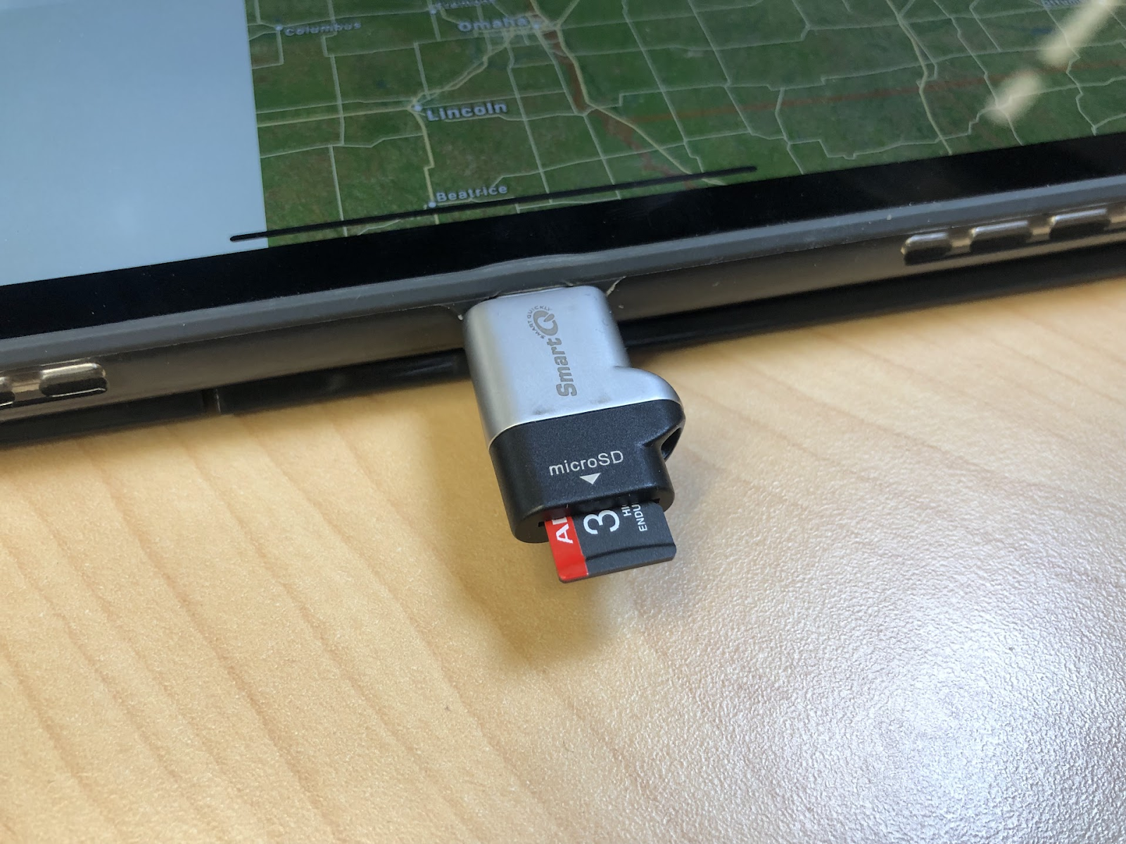
Mobile Stand Count only works on iPads . The newer the iOS device, the faster Stand Counts will process. You will also need a microSD card adapter that is compatible with your iPad.
Crop Types
-
Corn
-
Cotton
-
Potato
-
Soybeans
Crop Size
Plants should be at least 4 inches leaf across, leaf tip to leaf tip. Rowfill mode will be used when plants within a row are touching. Stand Counts can not be performed when the space between rows is covered by crop canopy.
Uploading (*online connectivity)
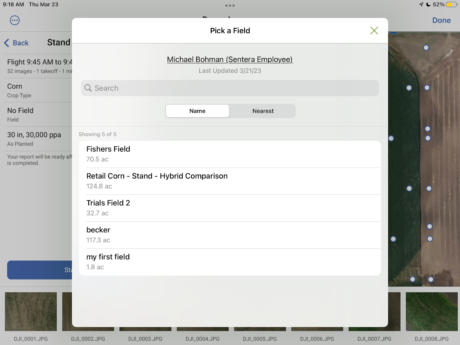
The iPad that is generating Mobile Stand Counts must be connected to the internet in order for Stand Count results to be uploaded to the cloud and accessible on the Web and Desktop. A field must also be selected when running Stand Counts so that the Stand Counts have somewhere to upload. File sizes on Stand Counts are designed to be extremely small, so as not to interfere with low data caps or connections in areas with slow connectivity.
How to use
Flight Planning for DJI Drones on FieldAgent Mobile
After setting an area or line, and camera:
Choose the
Stand
preset. This will set the correct altitude for your camera and set the overlap to capture at ~1 stand count per acre.
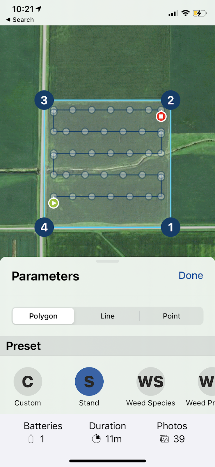
 WARNING: DJI Mavic and Phantom drones are set to fly at 50 feet in order to collect the imagery with the correct resolution. Use caution when flying at low altitudes.
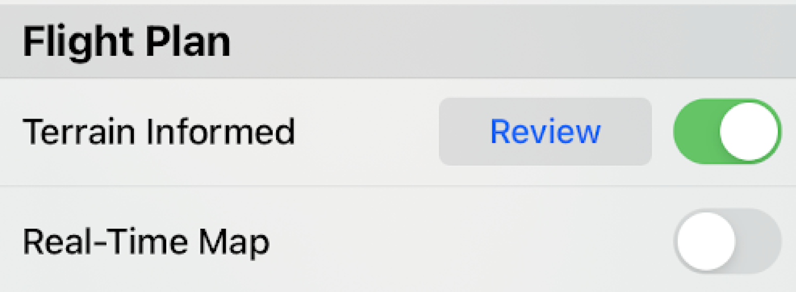
Non-Flat Terrain and Obstacles
When flying over non-flat terrain, Terrain Informed Flight Planning should be turned on as well. Note that while processing Mobile Stand Counts does not require an internet connection, planning a terrain informed flight DOES require an internet connection.
WARNING:
Concave flight boundaries with surrounding trees should be replanned as line missions.

Running Mobile Stand Count
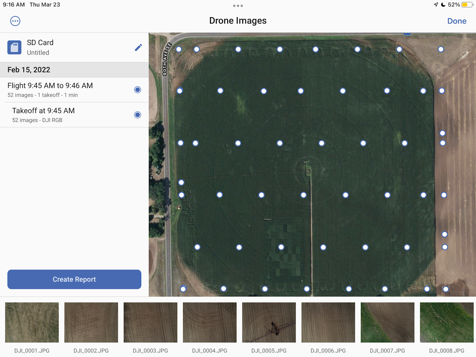
1. After flight, remove the SD Card from your sensor or drone and insert into an SD card reader attached to your iOS device.
2. From the Home Screen, tap the menu option for Dashboard and select Review Drone Imagery
3. Select Allow Access.
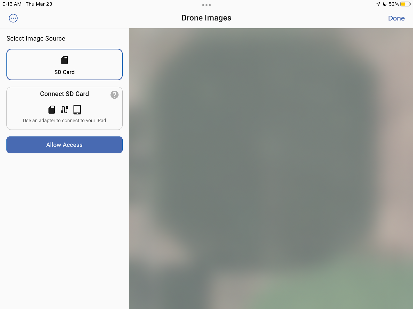
4. When prompted, select the SD Card in the finder window and then click
Done
.
FieldAgent will automatically search the SD Card for flights. Flights will be organized by date and time with the most recent flights on top.
5. Confirm the properties and edit as necessary.
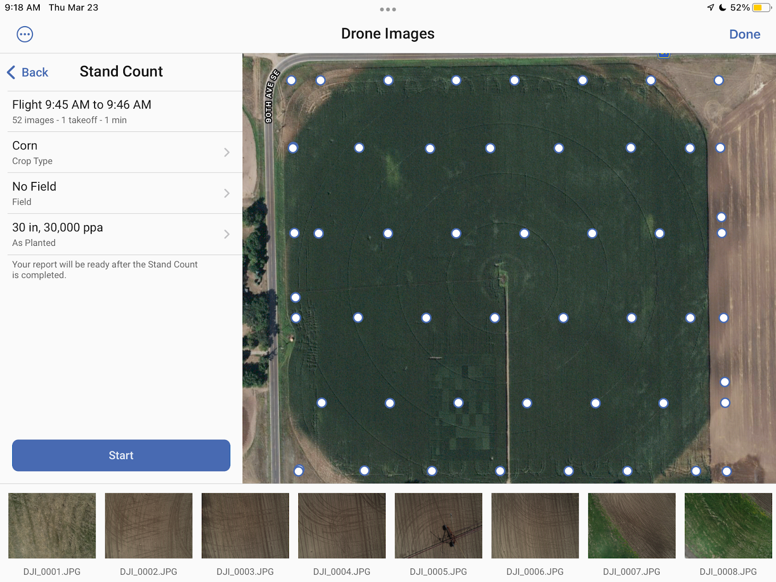
6. Once you’ve confirmed the properties, select Start.
Viewing and Analyzing Results
Progress Bar
A progress bar at the bottom of the screen provides an estimate for how much time remains in processing the selected Mobile Stand Count images.
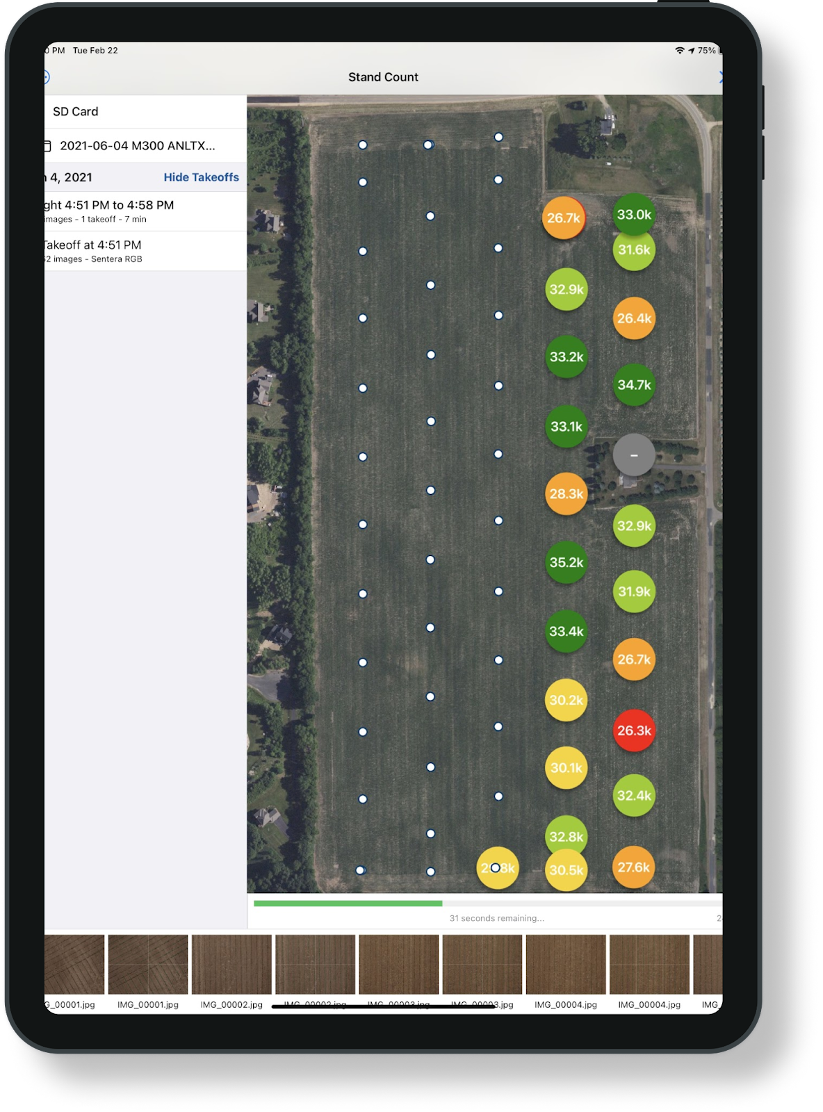
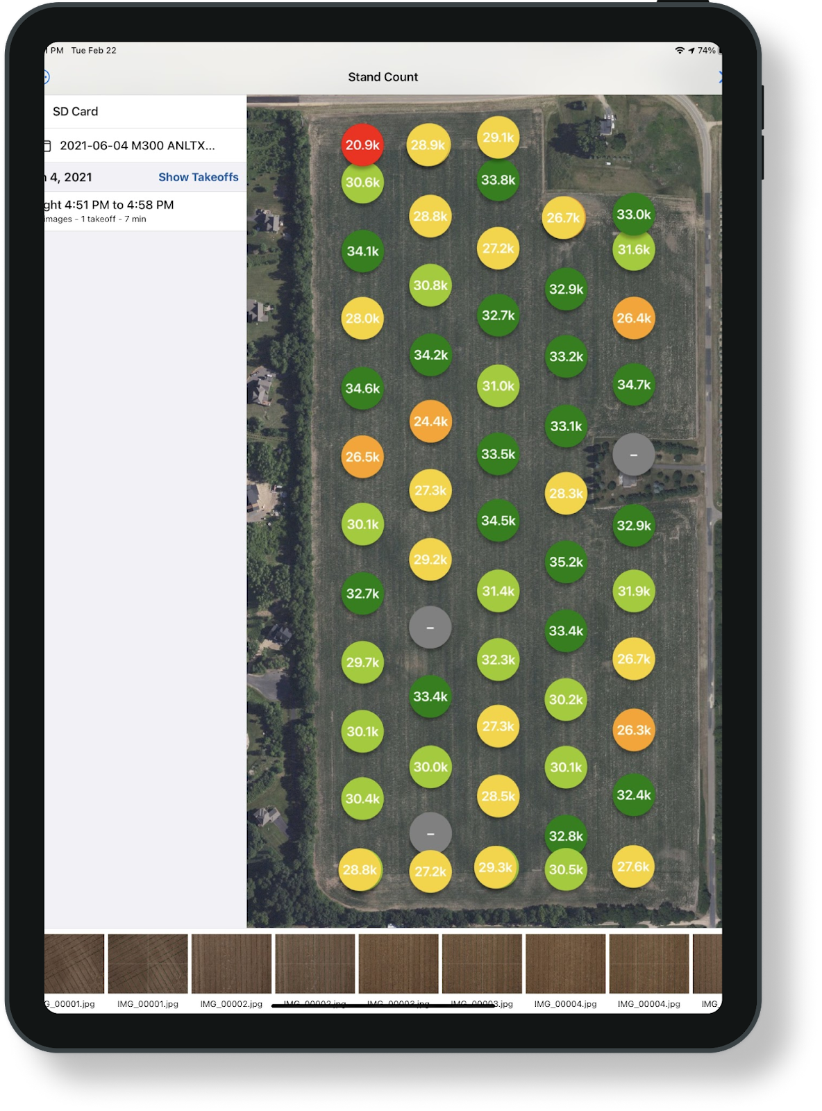
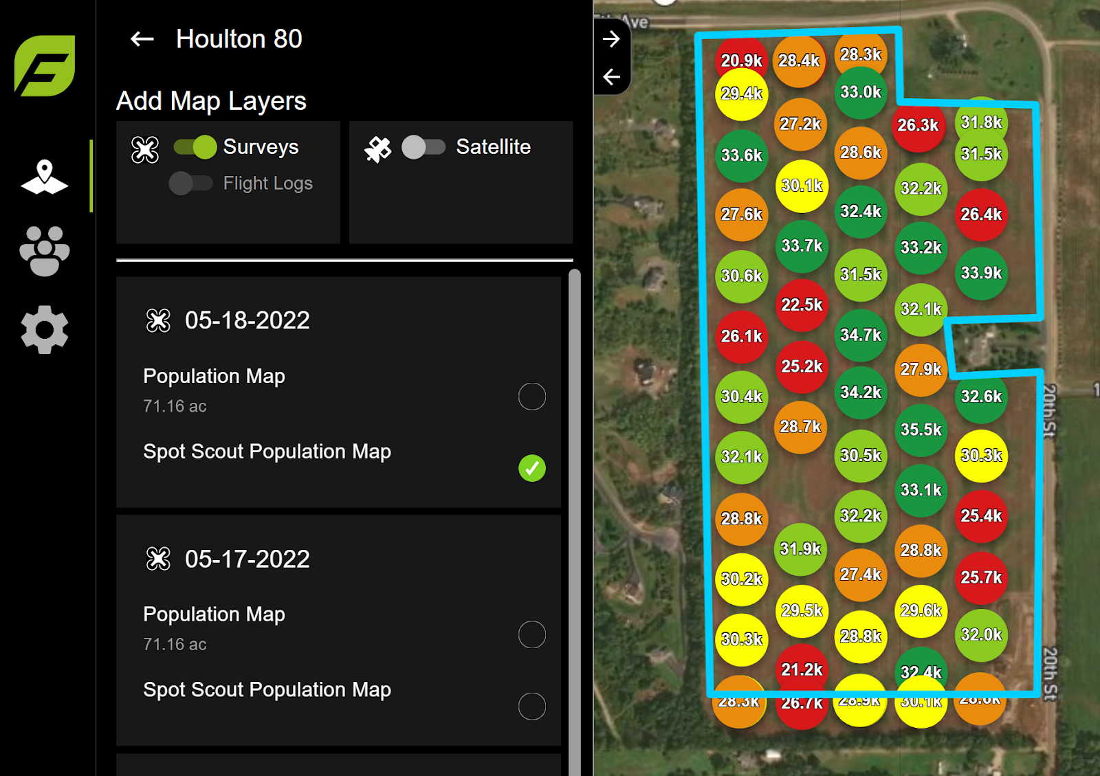
Numbered Discs
As images are processed, discs will appear on the screen in place of the white photo-dots at each image location.
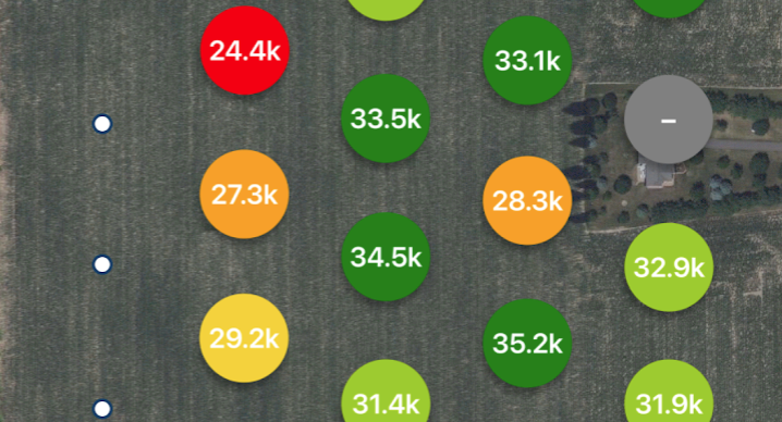
Each Stand Count disc displays the detected number of plants per acre and is colored according to how that number compares to the other Stand Counts on the screen. Dark green indicates a higher Stand Count, red indicates a lower Stand Count.
Recoloring of discs happens in real time. In the example below, a Stand Count in the lower right turns from red to orange as more images are processed.
--->
The discs can be selected to preview the image at that location. Select a disc and then press the magnifying glass to preview the annotated image at that location full screen.
PDF Report
Stand Counts can be shared as a PDF report after processing.
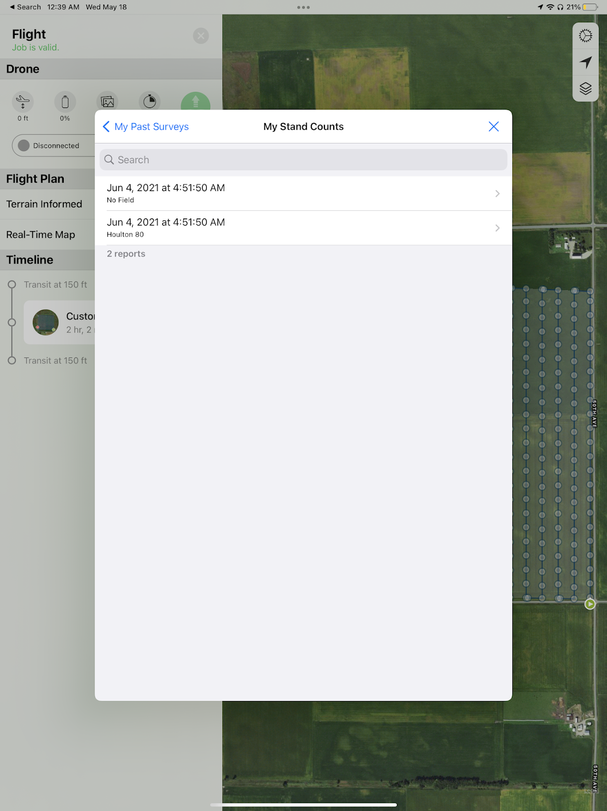
Accessing Previously Created PDF Reports
1. Click on the
gear settings icon
from any page in the mobile app and then
My Past Surveys
.
2. Select
My Stand Counts.
4. Share the report using the share icon in the lower right corner.
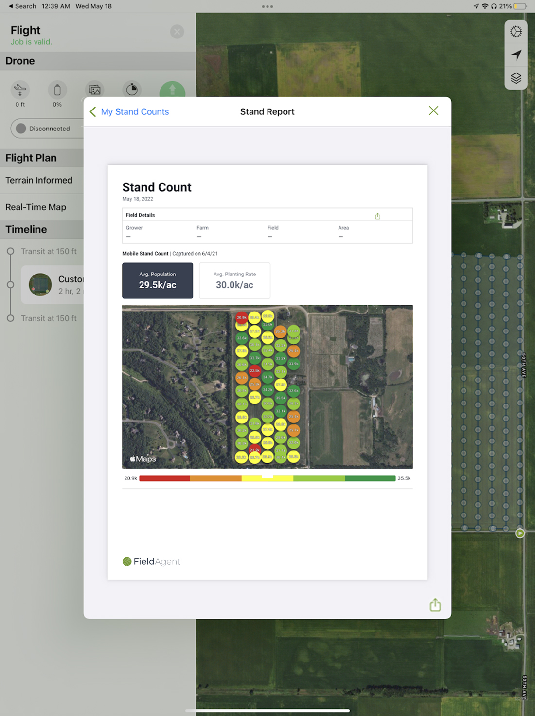
Sharing to the Cloud
Access Stand Counts generated by FieldAgent Mobile in the Web or Desktop by visiting the field page that the Stand Count was associated with and viewing the map layers.
Related Articles
FieldAgent Mobile - Data Collection Best Practices
NOTE: FieldAgent Mobile will now alert you when your flight plan will result in missed images. This warning applies to the onboard cameras for all DJI drones, as well as DJI Skyport enabled Sentera Sensors. DJI controlled sensors are only able to ...Stand Count - How to Capture and Import Imagery
FieldAgent Stand Counts allow you to efficiently and effectively capture population counts on every acre of your operation – processing images from throughout a field to identify every plant in every image for the most accurate and complete results. ...FieldAgent Desktop - User Guide
Field Agent Desktop User Guide English Engineered in Minneapolis, MN, USA 14 April 2022 Doc #67002 Rev E Copyright © 2022. All rights reserved. Trademark Notice FieldAgent, AgVault, and Incident Light Sensor are registered trademarks of Sentera. ...FieldAgent
Training Plan > Mobile User Guide Web User Guide Desktop User Guide Account Setup & Management Account Settings Enabling Location Services Ensuring Browser Compatibility Correcting the City and/or Country Field Management Draw, Edit, and Delete a ...FAQ: FieldAgent - Can I perform Tassel Counts with my Mavic or Phantom?
WARNING: Fly at your own risk. There are dangers of flying a drone at lower altitudes. Follow the directions below to carefully plan a safe and effective mission. Yes, tassel counts will work with the DJI Phantom 4 Pro or the DJI Mavic 2 Pro (with ...